10 Remarkable Hiking Trails Near Los Angeles
Are you an outdoor enthusiast planning a trip to LA? If you’re looking for an adventure involving hiking, Los Angeles has several trails. Whether you’re an experienced hiker or just starting, there’s a trail for everyone. From Griffith Observatory to the Mount Baldy Trail, here’s a list of 10 hiking trails near LA that you shouldn’t miss:
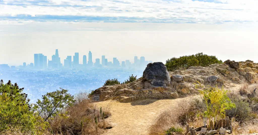
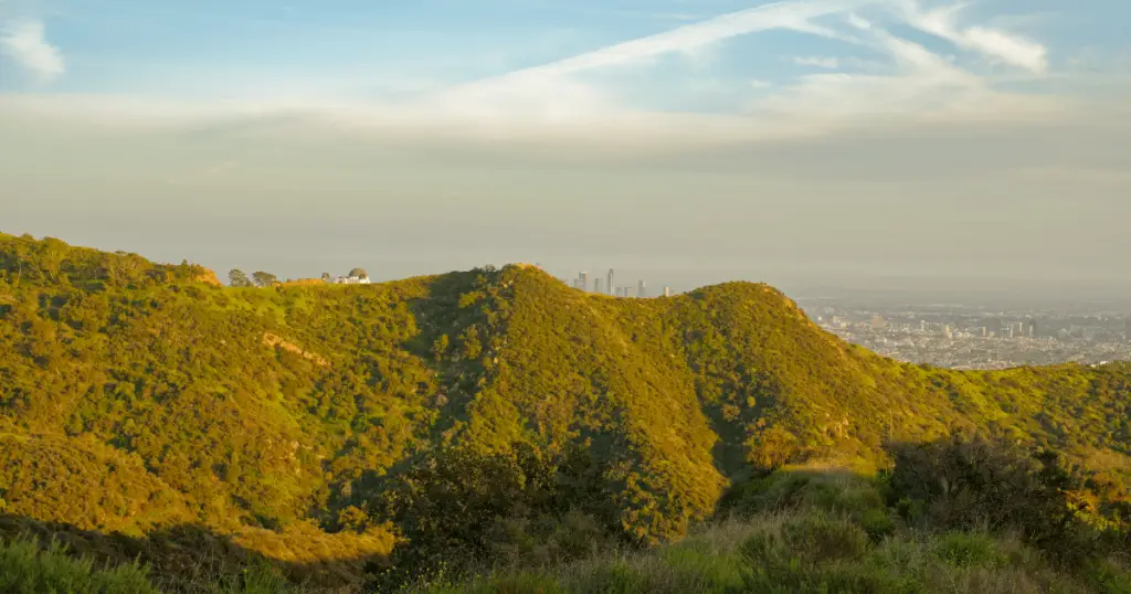
Griffith Observatory to Hollywood Sign Hike
This 8.8-mile round-trip hike is rated moderate in terms of difficulty, making it accessible to hikers with a basic fitness level. The trail takes you from the renowned Griffith Observatory through the lush scenery of Griffith Park, right up to the iconic Hollywood Sign.
Along the way, you’ll be treated to panoramic views of downtown Los Angeles, the Pacific Ocean, and the distant Catalina Island on clear days.
The final stretch of the hike delivers a close-up view of the Hollywood Sign that will surely be a highlight of your outdoor adventure. Please note that while the walk is not overly challenging, it does require a certain level of stamina due to its length.
Runyon Canyon Park
Located in the heart of Hollywood, Runyon Canyon Park is a hiker’s paradise with its diverse trails ranging from strolls to challenging climbs. The park boasts a 3.5-mile loop that offers a variety of terrains to satisfy every hiker’s preference.
The eastern side of the loop is a well-maintained trail with gradual inclines, perfect for beginners or those looking for a leisurely hike. On the other hand, the western side features a steeper path with rugged terrain designed to test the mettle of more experienced hikers.
One of the standout features of hiking at Runyon Canyon Park is the breathtaking views of the city. As you ascend the trails, you are rewarded with panoramic vistas of Los Angeles, stretching out to the Pacific Ocean.
Escondido Falls Trail
Tucked away in the Santa Monica Mountains, Escondido Falls Trail offers a memorable hike leading up to the highest waterfall in the range. The trail is in Malibu, stretching across an easily manageable 3.8-mile roundtrip.
The walk takes you through a verdant canopy of oak trees, over charming brooks, and ultimately, to the breathtaking Escondido Falls. The waterfall cascades over sheer rock faces, forming a multi-tiered spectacle that’s a sight to behold.
The lush surroundings and melodic sound of falling water create a serene environment perfect for nature lovers. It’s important to note that the trail’s conditions are subject to seasonal variations.

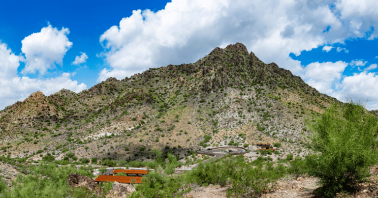
Sandstone Peak Loop
For hikers seeking a challenging adventure with rewarding views, the Sandstone Peak Loop is an ideal choice. This 6.25-mile trail is located in the Santa Monica Mountains, offering a strenuous journey to the highest point in the range, Sandstone Peak, which stands at an impressive 3,111 feet.
The trail’s terrain varies significantly, ranging from rocky paths to steep inclines, requiring moderate to high fitness. The challenge of traversing this trail is more than compensated by its breathtaking views.
As you ascend towards Sandstone Peak, you will be treated to panoramic vistas of the Pacific Ocean, the Channel Islands, and the sprawling cityscape of Los Angeles.
Solstice Canyon Trail
Solstice Canyon Trail in Malibu offers a unique blend of natural beauty and historical exploration, making it a fascinating destination for history buffs and nature enthusiasts. This 6-mile trail, shrouded in a rich history and intriguing ruins, promises an unforgettable hiking experience.
As you journey through the trail, you’ll encounter the remnants of the Keller House, a stone hunting lodge from the late 1800s, and the Roberts Ranch House, one of the oldest existing homes in Malibu, which unfortunately fell victim to wildfires.
Walking through these ruins, you’d be stepping back in time, retracing the footsteps of those who once called these structures home. The trail isn’t just about history, though. It’s also a stunning showcase of nature’s splendor, with the path winding through verdant forests alongside bubbling streams and culminating at a year-round waterfall – a rare sight in Southern California.

Bridge to Nowhere Hike
The Bridge to Nowhere Hike is an exciting trek into the unexpected, nestled deep within the rugged landscapes of the San Gabriel Mountains. This unique adventure takes you along a 10-mile trail that weaves through the untamed wilderness, peppered with river crossings and bouldered terrains.
What sets this hike apart is its final destination – an inexplicable yet intriguing sight of a concrete bridge poised amidst the sprawling wild. The trail is a test of natural endurance, with multiple river crossings that require careful navigation, particularly during the rainy season when the water flow is at its peak.
The terrain varies from sandy pathways to rocky elevations, demanding a decent fitness level from its adventurers. As you traverse the path, the silence of the wilderness is broken occasionally by the sound of gushing water and the rustle of wildlife.
Echo Mountain via Sam Merrill Trail
Echo Mountain via Sam Merrill Trail is a historical journey through time and a testament to the pioneering spirit of the late 19th century. Located in the San Gabriel Mountains, this 5-mile roundtrip trail invites hikers into the remnants of the Echo Mountain Railway.
As you venture up the well-maintained path, the route will reveal traces of the once-thriving incline railway. This railway was a transportation link to the grand “White City,” a resort perched atop Echo Mountain and a popular destination for adventure-seekers from Pasadena in the 1890s.
Today, the remnants of this railway era — rusted gears, twisted cables, and stone foundations — serve as historical markers, silently telling tales of the past. As you ascend the trail, nature unfolds its grandeur, offering panoramic views of Pasadena and beyond.
Vasquez Rocks Natural Area Park
Vasquez Rocks Natural Area Park is a geological marvel in the Sierra Pelona Mountains in northern Los Angeles County, California. This 932-acre park is renowned for its striking and unique rock formations that starkly jut out from the earth at angles as steep as 50 degrees, a phenomenon resulting from rapid erosion and tectonic activities over millions of years.
These distinctive formations create a dramatic, alien-like landscape and provide exhilarating and varied hiking options. The park boasts a network of trails, each offering its unique vista of stunning rock formations and expansive desert landscape.
The trails range in difficulty from easy to moderate, making it suitable for hikers of all levels. As you traverse these paths, you’ll encounter a varied topography – from sandy desert floors to steep rocky inclines. The Pacific Crest Trail, which stretches from Mexico to Canada, also passes through the park, adding to its appeal amongst avid hikers.
Devil’s Punchbowl Natural Area
Devil’s Punchbowl Natural Area is a geological spectacle in the San Gabriel Mountains of California. This 1,310-acre park is home to the eponymous Devil’s Punchbowl, a dramatic sandstone and conglomerate formation resulting from the violent clashing of two tectonic plates.
The weight of this geological event forced the softer sandstone to fold and uplift, creating a bowl-shaped canyon with strikingly angled strata. The result is a breathtaking vista of jagged cliffs, sloping ravines, and a bottom filled with scattered boulders – a sight as intriguing as its devilish name suggests.
As captivating as its geology is, Devil’s Punchbowl is a paradise for nature lovers, boasting a wealth of diverse flora and fauna. As you venture along the park’s network of trails, you’ll encounter a unique ecosystem that thrives amid the rugged landscape.
Chaparral, pinon pines, and Joshua trees dot the trails, while wildlife such as bobcats, coyotes, and over a hundred species of birds call this area home. The trails vary in difficulty, making this natural wonder accessible to hikers of all skill levels.
Mount Baldy Trail
Mount Baldy, officially known as Mount San Antonio, towers high as one of the tallest peaks in Southern California, reaching a staggering elevation of 10,064 feet. The splendor of Mount Baldy lies not only in its impressive altitude but also in the challenging and exhilarating hiking experience it offers.
The Mount Baldy Trail, also known as the Devil’s Backbone Trail, is a popular route amongst seasoned hikers, with its steep inclines, rugged terrains, and varying pathways.
The trail winds through stunning landscapes featuring pine forests, meadows, and rocky outcrops, steadily increasing altitude as you progress. With the trail leading up to such a high elevation, hikers can experience temperature and atmospheric pressure changes, adding an extra layer of challenge to the journey.
Conclusion: Hiking Trails Near LA
Southern California’s diverse and captivating landscapes offer a wealth of hiking experiences, each unique in its challenges and rewards. From the dramatic rock formations of Vasquez Rocks Natural Area Park, the rugged beauty of Devil’s Punchbowl Natural Area, to the exhilarating heights of Mount Baldy, each hiking trail presents its unique blend of natural beauty, geological intrigue, and rich biodiversity.
These trails offer an escape into the heart of nature and a journey of adventure and exploration, of pushing one’s limits and reveling in the sense of accomplishment. Whether you’re a seasoned hiker, a nature lover, or a casual adventurer, Southern California’s hiking trails promise unforgettable experiences that leave you with an enduring appreciation for the marvels of nature.